 Two disturbances in the Atlantic are right on the verge of strengthening into tropical depressions or storms, and one is worth watching for people in Florida and the Caribbean.
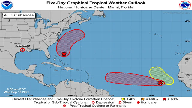
A low-pressure area of thunderstorms a few hundred miles south of the Cabo Verde Islands has the highest chances of strengthening, according to the National Hurricane Center’s 8 a.m. update, which gave it an 80% shot of forming in the next two days and 90% within the next five.
Models are all over the place with this system, but it is generally expected to head west-northwest for the next few days. If it survives and strengthens, it could reach an area north of the Lesser Antilles early next week. But since models are having a hard time getting a hold of this storm, it’s hard to know for certain at this point.
Meteorologists have also pointed out that the system might encounter a plume of Saharan dust, which can snuff out storms, in the next day or so.
Another disturbance on the cusp of strengthening into a tropical depression or storm is a few hundred miles northeast of the central Bahamas. Forecasters said the system is likely to develop in the next several days and head north. They gave it a 60% chance of forming in the next two days and a 70% chance in the next five.
At this point, models show it following the U.S. coast but not making landfall, although it’s too soon to tell.
The next storm names are Odette and Peter.
The hurricane center is also tracking a new disturbance over by Africa, another tropical wave expected to roll out into the ocean in the next few days. Forecasters gave it a 20% chance of forming in the next five days.