 Tropical Storm Warning Discontinues…Danny Slows Down…
The Centre Of Tropical Storm Danny Is Expected To Pass About 75 Miles South Of St.Kitts-Nevis This Morning. This Puts Our Islands Out Of The Range Of The Storm Force Winds. Hence, the Discontinuation Of The Warning.
Danny Remains A Minimal Tropical Storm That Could Dissipate In The Next 24 To 36 Hours.
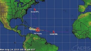
At 5 Am Ect or 0900 Utc, The Centre Of Minimal Tropical Storm Danny Was Located Near Latitude 15.8 North, Longitude 60.5 West Or About 155 Miles South-Southeast Of St. Kitts-Nevis.
Danny Is Moving Toward The West At A Reduced Speed Of 9 Mph, And A Westward To West-Northwestward Motion Is Expected Over The Next 48 Hours.
Reports From A NOAA Hurricane Hunter Aircraft Indicate That Maximum Sustained Winds Remain Near 40 Mph With Higher Gusts.
Tropical Storm Force Winds Extend Up To 60 Miles From The Centre.
The Estimated Minimum Central Pressure Is 1007 Mb Or 29.74 Inches.
Danny Is Expected To Cause Cloudy Skies, Showers And Possibly Thunderstorms Across Our Islands.
Rainfall Totals Should Generally Not Exceed 2 Inches.
Marine Warnings Are In Effect, As Seas Are Deemed Hazardous With Wave Heights Near 2.4 Metres Or 8 Feet.
Residents Should Continue To Monitor The Progress Of Danny Until It Is Out Of Our Area Or Has Dissipated.
Repeating The 5 Am Ect Position, 15.8 N, 60.5 W. Movement Toward The West Near 9 Mph. Maximum Sustained Winds Are Near 40 Mph. The Minimum Central Pressure Is 1007 Mb.